View Larger Map
Caribbean
View Larger Map
Leewards & Windwards
View Larger Map
The Windwards refer to the island chain from Martinique in the North to Grenada in the South. The Leewards are the islands from Dominica north.
Martinique
View Larger Map
Martinique is a Department of France. We chose it as our arrival point after the Atlantic crossing because we thought it would be like arriving in France. Well, some French people we met described it as "Yes, it's France, but it's not France". To me the place felt more like a French speaking third world country, although a pretty affluent third world country at that.
We stayed for a total of 6 weeks, partially to recover from the crossing, partially to make repairs to the things that broke on the way over, and of course to visit the island & see the sights.
Martinique, Le Marin
View Larger Map
This is a deeply indented bay in the southeast tip of the island. For anyone in a boat, this means lots of shelter. There can be some fairly big waves out at sea, but short of hurricane conditions the bay is like a lake, so no rolling around in the swell. However, it also means lots of boats. There is a 600 berth marina, and up to twice that number of boats anchored off. There are some more isolated spots around the bay, if you don't mind the long dinghy ride into town.
At least one river flows into the bay, so the water is a bit murky. Because of the murkiness and all the boats, we never felt comfortable about swimming here. We moved out to St Anne (scroll above map down slightly) at the entrance to Le Marin bay to scrape off the goose barnacles that grew on our hull while we were crossing the Atlantic. However we had to put up with rolling around in the swell while we were there.
Martinique, Fort de France
View Larger Map
A little further North is the capital of Martinique, Fort de France. Although also sheltered from the elements, the anchorage is right beside the ferry terminal, and with ferries coming and going every few minutes from early morning through until evening it got very rolly from their wakes.
Although a much bigger town than Le Marin, it is nowhere near as yacht friendly. There is one chandlers, and plenty of supermarkets, pubs etc., but it is a town focused on being capital of the Island, rather than on the boats anchored off.
St Pierre
View Larger Map
St Pierre in the North, is virtually not sheltered at all, but worth a visit in calm weather because of the volcano and its history.
St Lucia
View Larger Map
This is the next island south in the Windwards. It is an independent country.
Near to the northern tip on the West coast there is a reasonable anchorage in Admiralty Bay, which is the area just south of Pigeon Island. It is open to the West, but the winds normally don't come from that direction.
View Larger Map
However the lagoon just off it, Rodney Bay, is a natural harbour, and is sheltered from all directions. Nowadays, the lagoon is filled with a couple of marinas, private docks on shoreside properties, and what space is left over is taken up with moorings. So it is no longer possible to anchor there.
The "Googlemaps" version of Marigot Bay is nothing like the place we visited, so I won't bother sticking up their map.
Soufriere and the Pitons.
View Larger Map
Soufriere is a pretty town, dominated by the Pitons, twin volcanic peaks that provide a dramatic foreground to the landscape. The whole area is a national marine park, and anchoring is forbidden. Moorings are provided for about EC$20, = about €6.50, a night. We picked one up about half a mile west of the town, in an area with the unlikely named of "the Bat Cave"!
There is a customs office in Soufriere where we were able to check out of St Lucia before departing for St Vincent.
St Vincent and the Grenadines
View Larger Map
The big Island in the north of the above map is St Vincent, and the Grenadines are the collection of little ones running south from it. All except the biggish island in the South of the map, and one of the tiny islands off it, which are Carriacou and Petit Martinique respectively, which are part of the country of Grenada.
We were advised that the entire northern half of St Vincent is cannabis growing country, lawless, and if we stopped there we would almost certainly be boarded by armed robbers. So we kept going until we reached a small bay about half way down the west coast called Wallilabou. Here there is a customs office, a hotel, a museum, and nothing else. Nothing that is, except the remains of the film set from the Pirates of the Caribbean. In fact the museum was part of the set, with nothing but a facade held up by scaffolding hidden behind it. But they put a roof over the scaffolding and made it weatherproof, then filled it with photos and other memorabilia from the making of the movies.
Again Googlemaps shows Wallilabou in the wrong place, so no point in zooming in on the map.
Here are some pictures we took there, see if you can spot anything familiar from the movies.


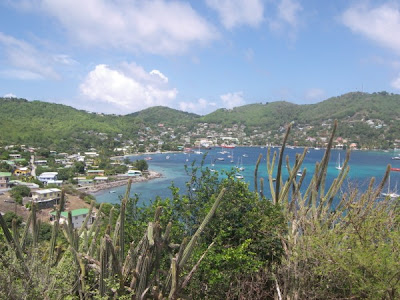
We didn't stop anywhere else in St Vincent, instead heading for our first Grenadine, Bequia. The massive sheltered bay on the west coast at Port Elizabeth makes it a popular spot for yachts.
View Larger Map
Looking at the map, the entire island looks like a harbour built around the anchorage. If you're wondering why all the anchorages are along the west coasts of the various islands it is because the trade winds blow almost constantly all year round from the east, so the West coasts are the sheltered side.
We met up with an American couple, Bill & Susan, and the four of us took a taxi on an island tour. Well, they call them taxis here, at home they call them pick up trucks, you just climb up on the back. Our taximan took the job to heart, and was proud to tell us about his island.
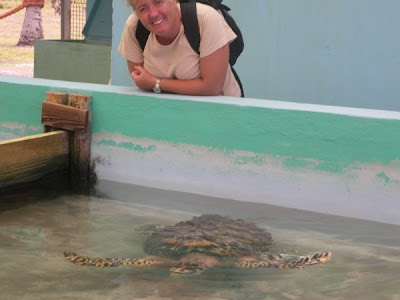
The tour also took in a turtle rescue centre. Pictures show the taxi, the anchorage, and a few sites from around the island.


Further south we visted the Tobago Cays, which are a handful of small islands and reefs. We anchored behind the reefs facing East into the Atlantic, the reefs protect you from the swell, but with nothing but ocean in front of us for two thousand miles to Africa. Sitting in the trade winds kept our wind generator spoinning, and it was great to see full batteries all the time.